Hiking Vanoise National Park: France's Hut-to-Hut Alpine Guide
By Triprz Editorial Team | October 10, 2026
France's first national park offers high-altitude hiking through alpine meadows, past glaciers, and between a network of 50+ refuge huts. Here's everything you need to hike the Vanoise.
Tags: Vanoise, French Alps, France, Hiking, National Park, Refuge Huts, Trail Guide, 2026
Article
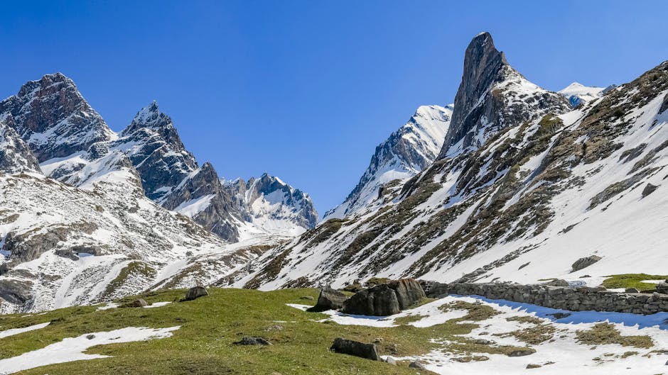
There is a moment on the Tour des Refuges when you crest a high pass, the wind dies, and the entire Vanoise massif opens before you — row upon row of glaciated peaks, stone refuges perched on ridgelines like tiny lanterns, and valleys so deep they seem to fold into the earth. No ski lifts. No roads. No crowds. Just you, the trail, and 53,000 hectares of France's oldest national park.

Vanoise was created in 1963, not for scenery or tourism, but to save the Alpine ibex from extinction. Hunters had decimated the population to a few dozen animals, and the French government drew a line around the massif between the Tarentaise and Maurienne valleys in the Savoie department. On the Italian side of the border, Gran Paradiso National Park had been doing the same thing since 1922. Together, the two parks form the largest protected alpine area in Europe — over 1,250 km² of contiguous wilderness.

Today, the ibex are back in the thousands, and the park that saved them has become one of the premier hut-to-hut hiking destinations in the Alps. Over 500 km of waymarked trails thread through alpine meadows, past 107 summits above 3,000 m, and between a network of more than 50 refuge huts where you sleep in dormitories, eat hearty mountain meals, and watch the sunset turn granite walls gold. Whether you are tackling the full Tour des Refuges circuit or spending a single day walking to Lac Blanc, this guide covers everything you need to hike the Vanoise.

---

## Park Overview

Vanoise National Park (Parc National de la Vanoise) sits entirely within the Savoie department of the Auvergne-Rhône-Alpes region in southeastern France. The park occupies the heart of the Vanoise massif — the third-highest mountain range in France after Mont Blanc and the Écrins — and straddles the watershed between the Tarentaise valley to the north and the Maurienne valley to the south. A 14 km stretch of its eastern border abuts Italy's Gran Paradiso National Park, creating a cross-border protected zone that allows wildlife to migrate freely between the two countries.

The park was established on 6 July 1963, making it France's first national park. Its founding mission was the protection of the Alpine ibex (bouquetin), which had been hunted to the edge of extinction. That conservation effort succeeded spectacularly — the ibex population now numbers in the thousands — and the park today shelters chamois, marmots, bearded vultures, golden eagles, and roughly 1,700 plant species, representing about a third of France's entire flora on less than 0.5% of the national territory.

The park is divided into two zones: the central zone (cœur du parc), where strict regulations protect the ecosystem, and a peripheral zone (zone d'adhésion) where villages, agriculture, and tourism coexist with conservation goals. Hikers spend most of their time in the central zone, where the refuges and high-altitude trails are located.

| Fact | Detail |
|---|---|
| **Location** | Savoie department, Auvergne-Rhône-Alpes, southeastern France |
| **Area** | 528 km² (central zone, ~52,839 hectares) |
| **Highest peak** | Grande Casse, 3,855 m |
| **Peaks above 3,000 m** | 107 |
| **Established** | 6 July 1963 (France's first national park) |
| **Trails** | 500+ km waymarked |
| **Refuge huts** | 50+ staffed and unstaffed |
| **Borders** | Italy's Gran Paradiso National Park (14 km shared border) |
| **Governing body** | Parcs nationaux de France |
| **IUCN category** | II (national park) |
| **Nearest towns** | Modane, Bourg-Saint-Maurice, Pralognan-la-Vanoise |
| **Plant species** | ~1,700 (roughly a third of France's flora) |

---

## The Best Hikes

The Vanoise offers everything from gentle half-day walks to multi-day alpine circuits. Below are six of the best, ranging from a family-friendly lake loop to a summit ascent that requires mountaineering experience. Distances and elevation figures are approximate — the Vanoise has many route variants, and conditions on the ground always determine your actual numbers.

### 1. Tour des Refuges (Tour de la Vanoise)

The Tour des Refuges — also called the Tour de la Vanoise or Tour des Glaciers de la Vanoise — is the park's signature trek: a hut-to-hut circuit that loops through the heart of the massif, crossing high cols, traversing glaciers, and stringing together a dozen or more refuges over roughly a week. It is the hike that brings most people to the Vanoise, and for good reason.

The standard route covers approximately 74 km with around 4,000 m of cumulative elevation gain and loss, typically completed in 6 to 7 days. The highest point on the classic line is the Col de Chavière at 2,796 m, though some variants push slightly higher. Most hikers start from Pralognan-la-Vanoise or Modane and walk counterclockwise, though the circuit can be begun from any valley access point.

Each night is spent in a different refuge — names like Refuge du Col de la Vanoise, Refuge de l'Arpont, Refuge du Col du Palet, and Refuge d'Entre Deux Eaux bec

[...]
Back to Blog | Back to Triprz